The Eclectic Mapper
As part of our commitment to being the geospatial learning and teaching hub for the College of Liberal Arts and Sciences and beyond at the University of Colorado Denver, we are now sharing our student publication, The Eclectic Mapper. Its purpose is to provide an online gallery/zine space for our student mappers to publicly display their work. Our students have developed and honed their map making/data graphic skills through classes taught in the FAST Lab by an excellent group of University of Colorado Denver faculty members drawn from the Geography and Environmental Sciences Department, the College of Architecture and Urban Planning, the Auraria Library, and affiliated Metropolitan Denver community GIS professionals.
The Eclectic Mapper began its journey to publication during Summer Semester 2021 as the COVID-19 pandemic was becoming managed. Our University of Colorado Denver community was getting prepared to be together again on the Auraria Campus. We wanted to develop a publication item that reflected our expanded content delivery growth experienced during the pandemic and being a piece that could be effective through in-person presentation as well. Its name plate and page format, overall design-philosophy strategy, and delivery method were finalized in December of 2021. During Spring, Summer, and Fall Semesters 2022 it was shared through various public forums. Additionally, we needed this piece to be flexible enought that its pages were inclusive and diverse in their presentation as ones reflecting our values as a community. Our community stake holders believe our path to an equitable future comes from creating work rooted in the ideals of justice, equity, diversity, and inclusion for all communities.
It is now available as will future volumes on the FAST Lab's website. Our FAST Lab Team members want to encourage all who take classes or enlist our help on their projects to share your work with us all through The Eclectic Mapper!
UCD and Auraria Campus Clubs
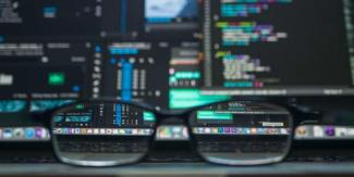 PyFAST
The PyFAST group is an opportunity to explore coding in Python in a casual environment. Interdisciplinary by design, the group is made up of students and professionals interested in data science. No experience necessary.
MaptimeMileHigh
Facilitated by our Auraria Library Geospatial Services Specialist Dr. Diane Fritz, this group gathers monthly to discuss all things geospatial.
The Broader GIS Community
Get involved with GIS organizations within the community. Here are some suggested organizations to check out:
Featured GIS Job Postings
Paid internship with the National Park Service: Coastal Vulnerability Assessment Database and Web Application
Paid internship with the National Park Service: National Information Services Division Resource/ Information Services Division