The Facility for Advanced Spatial Technology is a collaborative and interdisciplinary spatial analysis, cartography, and geovisualization teaching laboratory that forms the core of geospatial teaching activities on the Downtown Campus at the University of Colorado Denver. The FAST is sustained by a long-standing partnership between the College of Liberal Arts and Sciences (CLAS) and the College of Architecture and Planning (CAP) and receives additional support from the Auraria Library, the College of Engineering and Design Computing (CEDC), and the School of Public Affairs (SPA).
This interdisciplinary laboratory provides students with access to industry-leading geospatial faculty, staff, professionals, and fellow peers from more than twenty departments across the University and operates as one of the most robust geospatial teaching facilities in the Colorado Front Range.
Our physical location is:
- 5th floor, North Classroom Building
- Suite 5032-C
- 1200 Larimer Street
- Denver, CO 80217-3364


Credit: Maps created using ArcGIS Online. Esri basemap.
Click Here for Parking and Accessibility Map
FAST Advisory Committee Members
Diane Fritz, Ph.D.
Geospatial Services Specialist at Auraria Library
Austin Troy, Ph.D.
Professor & Chair of Urban and Regional Planning Department
Esther Sullivan, Ph.D.
Associate Professor in Sociology Department
Rafael Moreno, Ph.D.
Professor in Department of Geography & Environmental Sciences
Stephanie Kelly
Assistant Dean of Finance and Administration for the College of Architecture and Planning
Michael "Bodhi" Rogers, Ph.D., R.P.A.
Professor & Chair Department of Physics
Geospatial Consultants
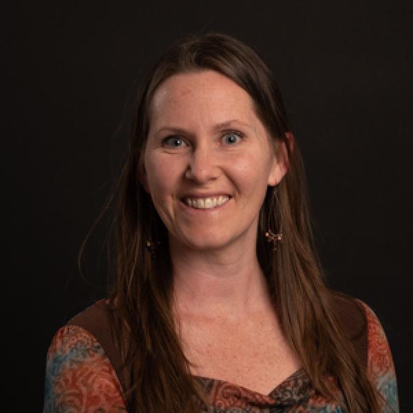
Fatema Hussaini: FAST Lab Coordinator
Fatema Hussaini, the coordinator for the Facility for Advanced Spatial Technology (FAST) Lab, has ambitious plans for the improvement of outreach and the adoption of spatial technology among students and faculty. The lab’s new goal under her guidance is to support student learning and skill development in geospatial analysis, cartography, and geovisualization. Additionally, they hope to host workshops and training sessions to expand student collaborations with different departments on campus and to support interdisciplinary students’ research. In the long term, they envision the Fast Lab as a hub for innovative geospatial research, recognized within the university. The aim, according to Fatema, is “to contribute to the advancement of geospatial technologies and their applications in various fields, including geology, geography, architecture, archaeology, urban planning, and environmental analysis”.
With a background primarily in the field of geography, Fatema holds master’s degrees in geography and urban planning, as well as a master’s degree in Earth and Environmental Sciences, with a focus on Geoinformatics, from Murray State University in Kentucky. When asked why she came to CU Denver, Fatema said she was “drawn (here) because of the University’s excellent reputation.” She believes that “working in academia allows individuals to engage in intellectual pursuits and to constantly learn and grow.” The Fast Lab's focus is geospatial analysis, which involves data and information related to geographic locations.
(Note: The information provided above is sourced from the Dean's Notes.)